India: Agri ministry to use remote sensing tech to map area under potato & onion cultivation
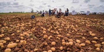
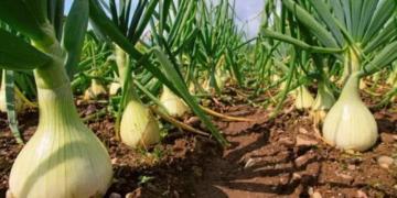
NEW DELHI: The agriculture ministry plans to use remote sensing technology to map the area under potato and onion cultivation for the entire country to provide an accurate estimate of the likely production of the respective crops.

This would be extended to cover orchards in the next phase. "We are working on producing robust estimates of the area and production of important crops like potato and onion for the whole country through remote sensing," said an agriculture ministry official.
He said the department was working on uploading maps of fruit crops (from oranges to mango) onto the Bhuvan platform -- a software application browser which explores 2D/3D representation of topography. Currently, details of mango orchards are being worked out in three major districts of Karnataka and other states and their database creation is being done on Bhuvan, the official said. Maps on areas under mango cultivation maps have already been finalised in the major mango producing districts
The ministry is also working on developing a methodology for precision farming and assessment of major vegetable crops under a project called ’Coordinated Horticulture Assessment and Management using Geo-Informatics’ (Chaman). Launched in September 2014, the project is targeted to be completed in three years at an estimated cost of Rs 13.38 crore, the agriculture ministry stated.
The programme aims to develop a methodology to estimate the area under horticulture crops and its likely production using remote sensing technology and sample survey methodology.
The methodology for estimation of areas under other crops like tomato, chilli, mango, banana and citrus has also been developed, the ministry stated.
Fuente: http://economictimes.indiatimes.com/news/economy/agriculture/agri-ministry-to-use-remote-sensing-tech-to-map-area-under-potato-onion-cultivation/articleshow/56227612.cms